
» North Parcel West A
2011 Monitoring Data/Site Descriptions Descriptions taken May 2011.
2010 Monitoring Data/Site Descriptions Descriptions taken April 2010.
2009 Monitoring Data/Site Descriptions Descriptions taken April 2009.
2008 Monitoring Data/Site Descriptions Descriptions taken April 2008.
2007 Monitoring Data/Site Descriptions Descriptions taken April 2007.
Monitoring Data/Site Descriptions
Descriptions taken April 2006. Click the link above to view or download the monitoring data file. (Adobe Acrobat PDF)
2011 Monitoring Photos
2010 Monitoring Photos
2009 Monitoring Photos
2008 Monitoring Photos
2007 Monitoring Photos
2006 Monitoring Photos
Characterization Photos
Click the link above for site photos.
Maps
2000/2003 FLUCFCS Comparison Graphic
Exotic Species Map, 2006
Exotic Species Map, 2000
Prescribed Burn Information
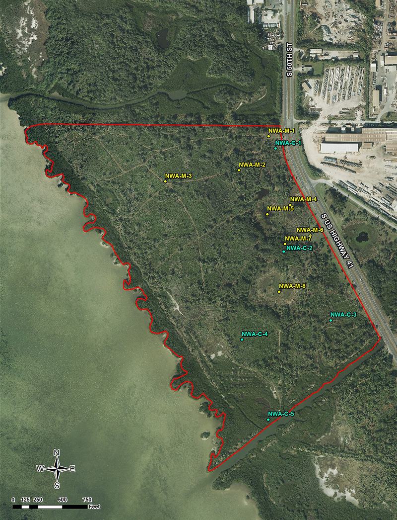
Mosaic, working in partnership with the Division of Forestry and Milam Environmental, has performed controlled burns on Parcel Northwest A, most recently in March of 2009. This maintenance burn is performed in effort to keep exotics from reintroducing into the area and to maintain the integrity of the restoration work that was conducted as part of the Riverview Gyp Stack team permitting project. For more information, please contact VHB's Clayton Robertson at crobertson@vhb.com.
2006 Prescribed Burn Aerial Photo

Mosaic will continue to monitor the progress of restoration work that has been completed over the past seven years. This parcel will continue to be treated as necessary to reduce the number of exotic species that may regenerate over time. |